- Base property consists of 600 acres of farm ground in Union, Oregon
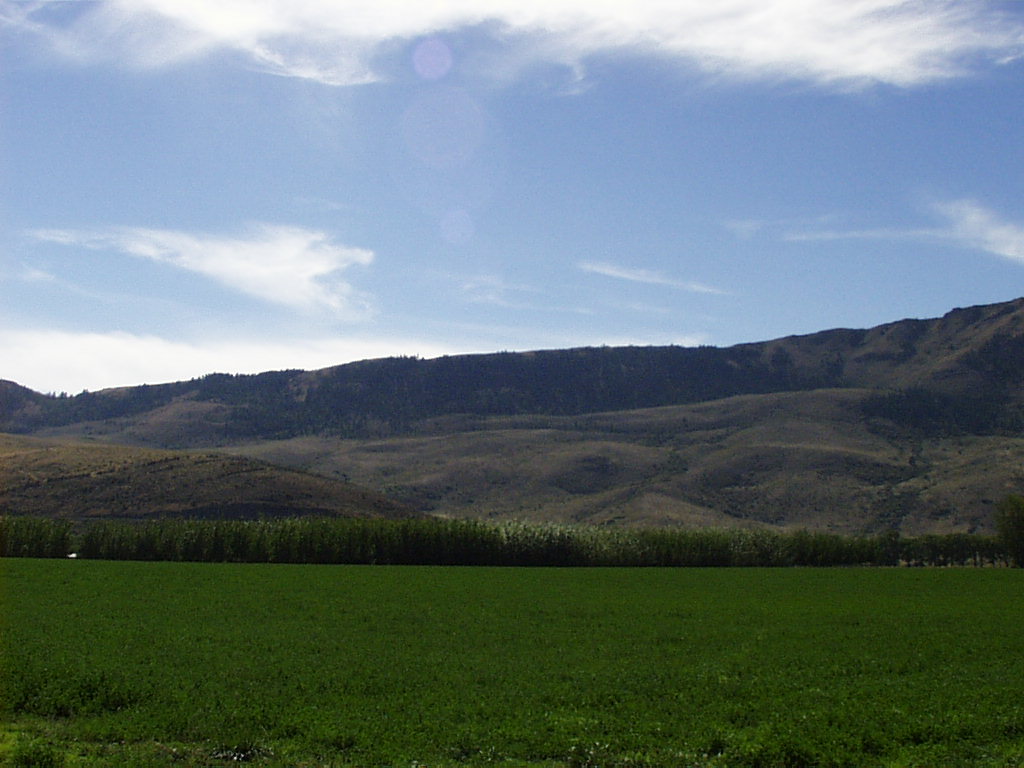
- The Hall Ranch is approximately 2,000 acres of forested land located 12 miles southeast of Union on State Highway 203
Facilities and accommodations: Office and laboratory facilities; barns, buildings, and equipment necessary to run an agricultural experiment station. Laboratory equipped to run basic nutritional analyses and micro-histological analysis. Areas are available for field trip camping and limited housing is available for graduate students.
Establishment: Base property -- 1901. Hall Ranch -- 1939. Legal source of establishment and current ownership: Oregon State University, Corvallis.
Climate: Base Property -- Annual precipitation averages 14 inches. Snowfall is possible from November through April, and averages 26 inches annually. Mean temperatures range from 24 F (January) to 84 F (July), but temperatures below 0 F or exceeding 100 F are possible.
Hall Ranch -- Fall and spring are cool and moist, while summers are hot and dry. Precipitation averages 26 inches. Snow is common and may be continuous in winter months. Accumulations in excess of 28 inches are possible. Temperatures range from 0 F (January) to 100 F (July).
Physical features: Elevation of the base property is 2,769 feet. Soils originate from two dominant parent materials: (1) silt sized volcanic ash originating from Mount Mazama eruptions: and (2) basalt. Elevations of the Hall Ranch range from 3,937 to 5,905 feet. Four soil series are found on the Hall Ranch: the Tolo, Klicker, Hall Ranch, and Chop silt loams. Pumicite is found in varying amounts in all soils.
Vegetation: The station base property is farm ground comprised of cropland for alfalfa and grain production. Additionally, non-tillable acres are seeded to pasture grasses, primarily tall fescue (Festuca arundinacea). The Hall Ranch is primarily forest land suitable for livestock grazing. Vegetation groups on the Hall Ranch are grand fir (Abies grandis) forest on the north slopes, mixed conifer forest, wet meadow, and riparian. Dominant plant species are grand fir, Douglas-fir (Pseudotsuga menziesii), ponderosa pine (Pinus ponderosa), ninebark (Physocarpus malvaceus), ocean spray (Holodiscus discolor), snowberry (Symphoricarpos albus), pine grass (Calamagrostis rubescens), elk sedge (Carex geyeri), and Kentucky bluegrass (Poa pratensis). Portions of the Hall Ranch have been clearcut and seeded to orchardgrass (Dactylis glomerata), timothy (Phleum pratense), blue wildrye (Elymus glaucus), smooth brome (Bromus inermis), and white dutch clover (Trifolium repens).
Livestock management: Cattle are owned by Oregon State University. The cattle herd has 200 cows, 20-50 replacement heifers, and 80 steers kept to long yearlings. Cattle are maintained on the base property from mid-October to mid-June. Hay is fed from December 15 to May 15. Cattle are grazed on the Hall Ranch and on the US Forest Service Starkey Experimental Forest the remainder of the year.
Current research thrusts: Evaluation of ecologically and economically sustainable animal agriculture in northeastern Oregon. Research will focus on compatibility of livestock with forested range ecosystems. In addition, research is focused on economic sustanibility with particular emphasis on alternative winter management and reproductive efficiency.
Importance of site:
The long-term data base on climate, vegetation, timber and livestock.
Climatic data
Base property, Union - 1901 to present: Temperature - daily maximum and minimum; Precipitation - daily (24 hour totals); 1973 to present: Growing season evaporation; Precipitation - continuous recording; Wind - totalizing anemometer by direction on 60 foot tower; Relative humidity and temperature - hygrothermograph; Soil temperature - 24 hour maximum, minimum at 12 inch depth.
Hall Ranch - 1956 to present: Monthly maximum and minimum temperature and precipitation.
Plant data
Base property:
Historic data (before 1970) on crop varieties and yields.
Hall Ranch
1) Two exclosures were established on the Hall Ranch in 1958 in Ponderosa pine/ninebark and grand fir/myrtle pachistima habitat types. Measurements taken every 10 years both inside and outside the exclosures are frequency and production of the herbaceous vegetation, frequency and canopy cover of the shrubs, and canopy cover of the trees.
2) Three exclosures were established the year after logging on the 1963 clearcut. Forage production, frequency of both herbaceous plants and shrubs, and tree height and diameter have been measured since 1964.
3) Four exclosures were established in 1972 in three different habitat types on the 1969 clearcut. Herbaceous biomass and frequency, shrub canopy cover and density have been measured at 10 year intervals both inside and outside the exclosures. The above exclosures help describe successional trends in vegetation exposed to logging and grazing by large ungulates.
4)A long-term study initiated in 1978 is evaluating frequency, canopy cover, and production of several communities within a riparian zone.
5) Data are also being collected to evaluate the influence of grazing treatments on vegetation composition, small birds, and mammals.
Livestock data
1901-1981: Daily gain, fertility on sheep and cattle.
1981-present: Daily gain, fertility on cattle.
1956-present: Seasons of use, stocking rates.